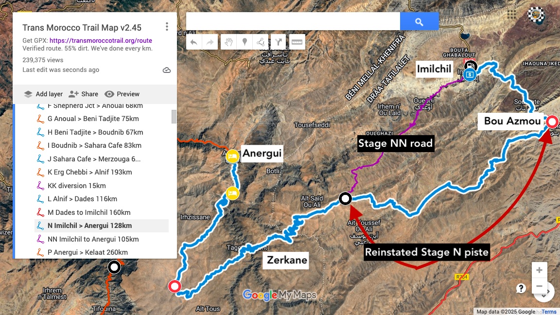
We rode the original TMT-N piste out of Bou Azmou today. It was revised about a year ago when heavy rains made the track through a narrow flood-prone gully at KM52 hard work for all vehicles. At the same time a new road was built directly from Imilchil, avoiding this section and passing just just 5km from the gully while not being a huge diversion round the north to Anergui,.
We can report this part of the route is back to as it was when originally logged in early 2024 in a Land Cruiser, before a storm trashed the gully. The triail still has rough episodes, but nothing you’ll not have encountered on the TMT so far, while being up at over 2500 metres.
This gully is certainly easier than the last time one of us rode it in the spring, so this section has been reinstated as TMT-N, 128km from Imilchil to Anergui at around 50% piste. The easier road direct from Imilchil is now diversion NN on the latest map, still a very nice drive and saves about 13km. Take NN the next time heavy rains trash that gully, which is bound to happen.

And fyi, they’ve had a busy summer and have sealed just about the entire road from KM57 where Bou Azmou piste joins NN, to Anergui turn off around KM102. New bridges have been built and road beds carved from the hillsides. Some hairpins are still dirt, as is half the big descent into the deep valley between Zerkane and Taguertoucht villages. There is lots of loose gravel on the new surface but three boys are diligently working their way along the road with brooms.
The TMT Map had been updated, and so has the OSM database.
Leave a Reply