Get H.A.T gpx now: https://motorcycleadventures.eu/hat/
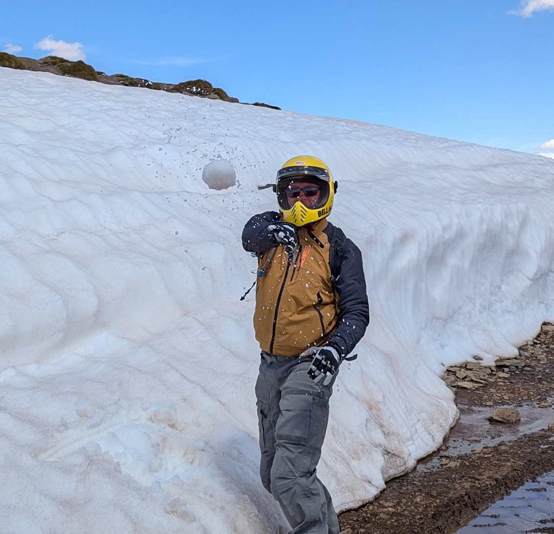
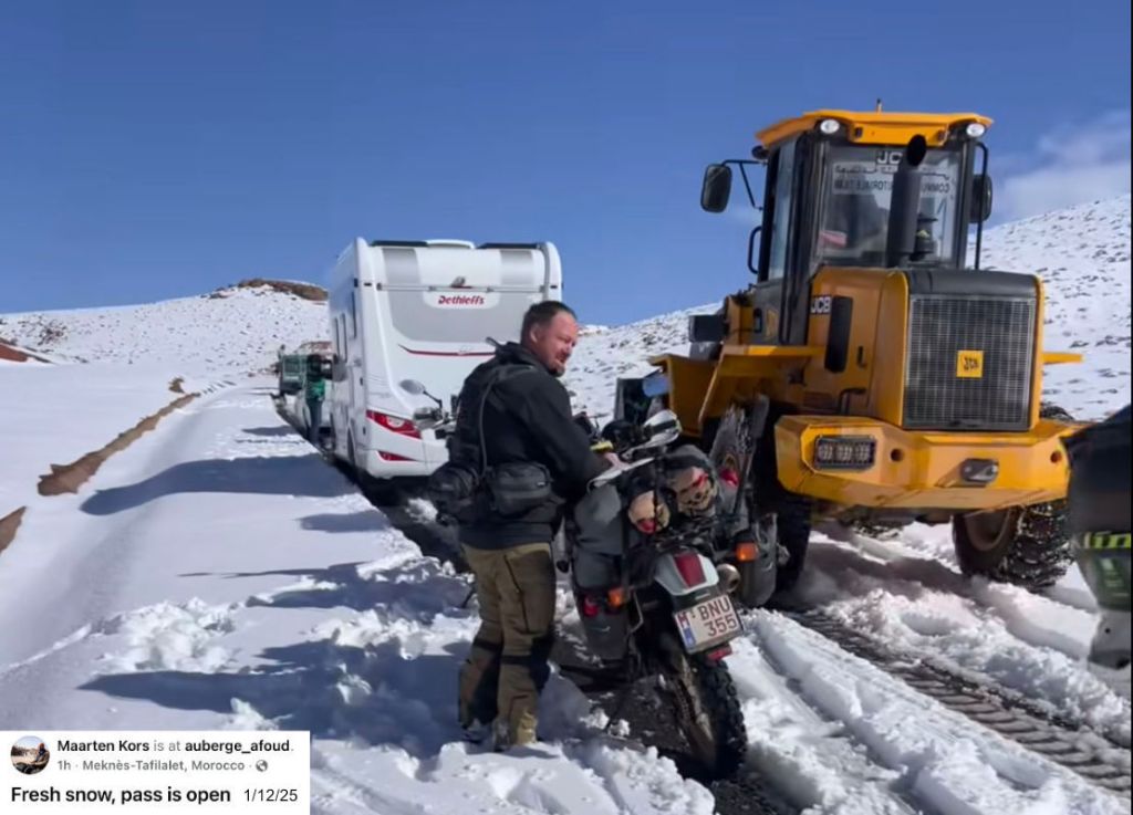
H.A.T recce gallery.
Winter 2026
heavy snow RIGHT across the Atlas.
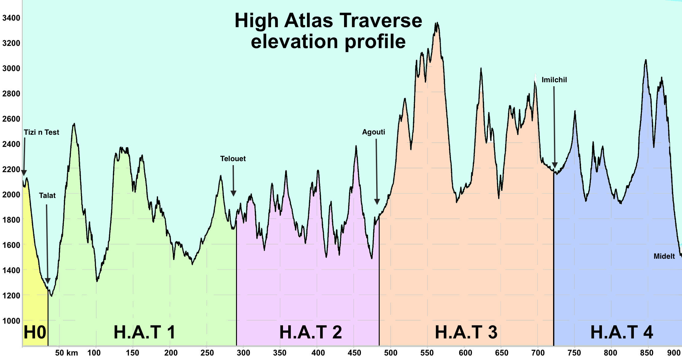
higher elevations on H3 AND H4 almost certainly impassable until the spring thaw
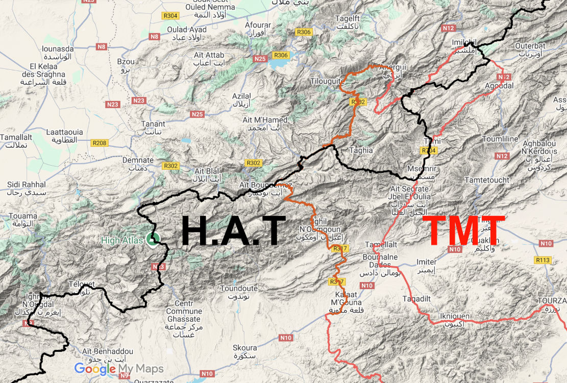
Following the success of 2024’s Trans Morocco Trail, new for 2026 is the High Atlas Traverse, tracing the mountain watershed via the highest passable routes. A watershed is a geographical boundary along a mountain chain’s highest ridge line: on one side Atlas rivers flow north to the Mediterranean or Atlantic; on the other they drain into the Sahara and disappear.
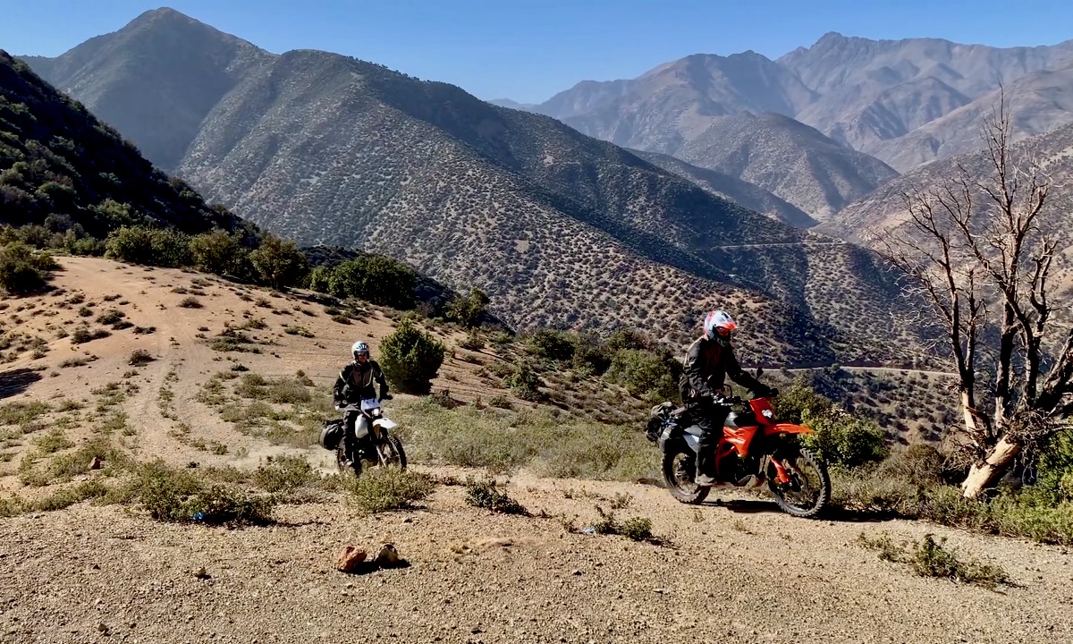
Like the TMT, the H.A.T is about 50% dirt, and is pitched primarily at MTBs, 4x4s and lighter all-terrain motos. The route has been corrected on the OSM database, where necessary. These edits will eventually feed down to the free-to-download, OSM-based digital maps.
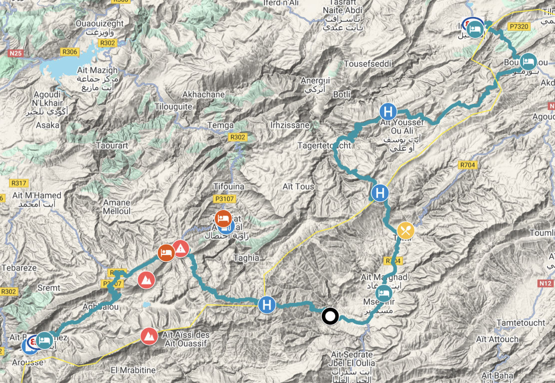
The HAT is comprised of Stages 0 to 4 (above). To read more about each one scroll down. The TMT FAQs have been revised to cover the H.A.T. Please make sure you read them.
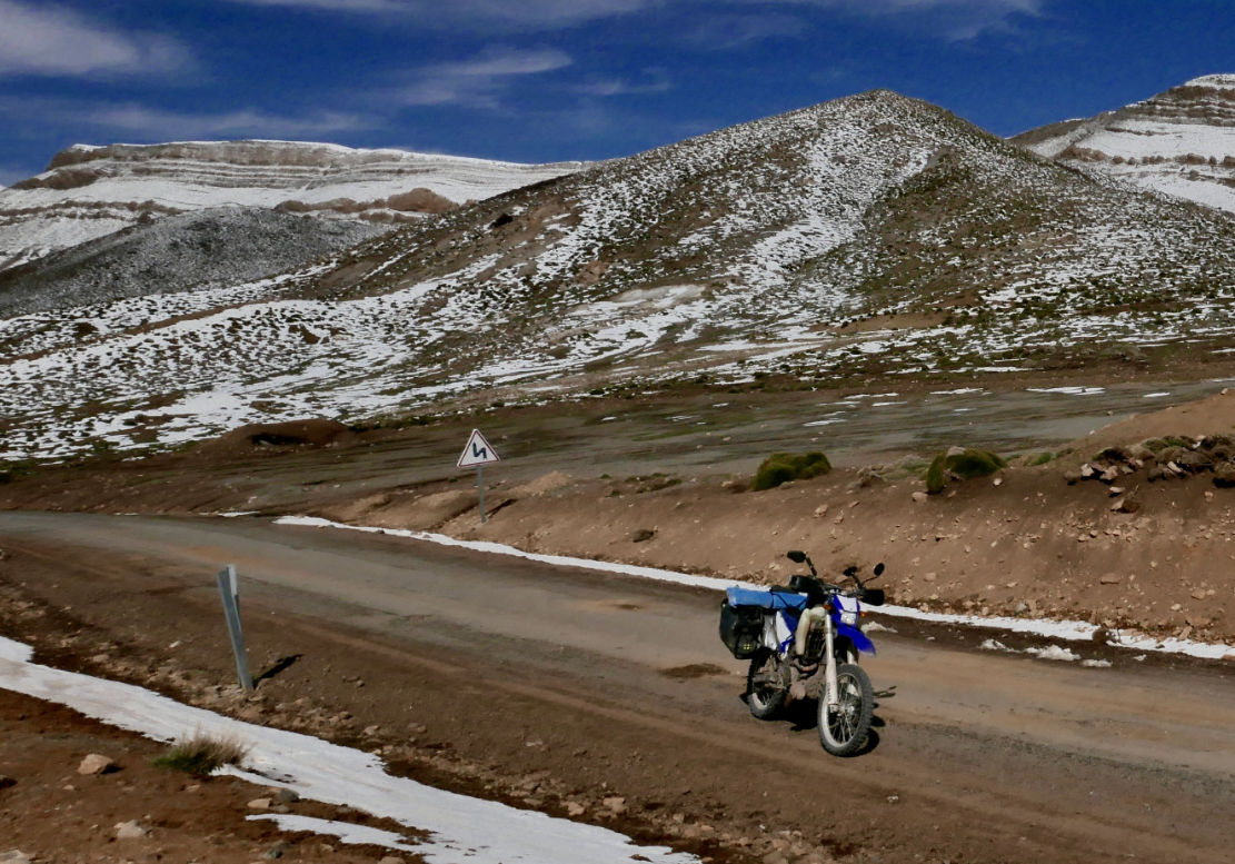
Unlike the TMT which showcases Morocco’s full diversity of landscapes from sea to ocean, the H.A.T prioritises sticking close to the mountain watershed while navigating whatever tracks exist. A short distance into Stage 1, the route rises above 1500m (5000′) and stays that way for the next 800km to Midelt (1508m). Stages 3 and 4 remain over 2000m for nearly 400km, passing the high point at 3340m (11,000′). These kinds of elevations aren’t normally sufficient to affect most healthy people, through you may experience brief breathlessness and your engine will lose up to 30% of its power. Some carb fed engines may run poorly.
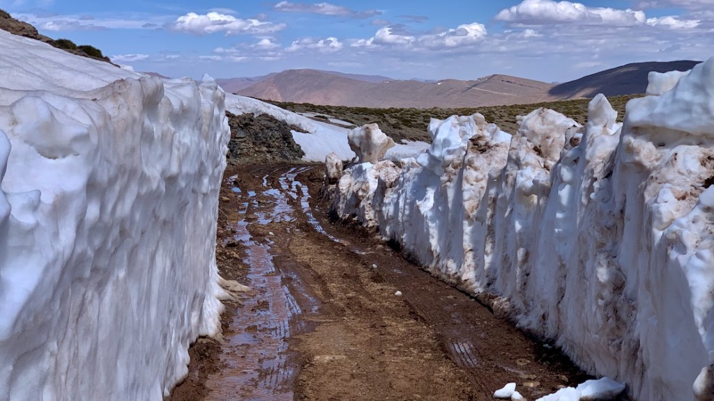
I would guess H0 to H2 (Agouti) will be passable through the winter or won’t get deep in snow for long. But as you can see on the elevation profile above, H3 and H4 rise much higher and will probably become snowbound in winter. Being much less used tracks, they’ll be left until the spring thaw when they’ll turn slushy or get plain washed-out following storms and rockfalls. So above all, know when to turn back or be prepared to accept the consequences.
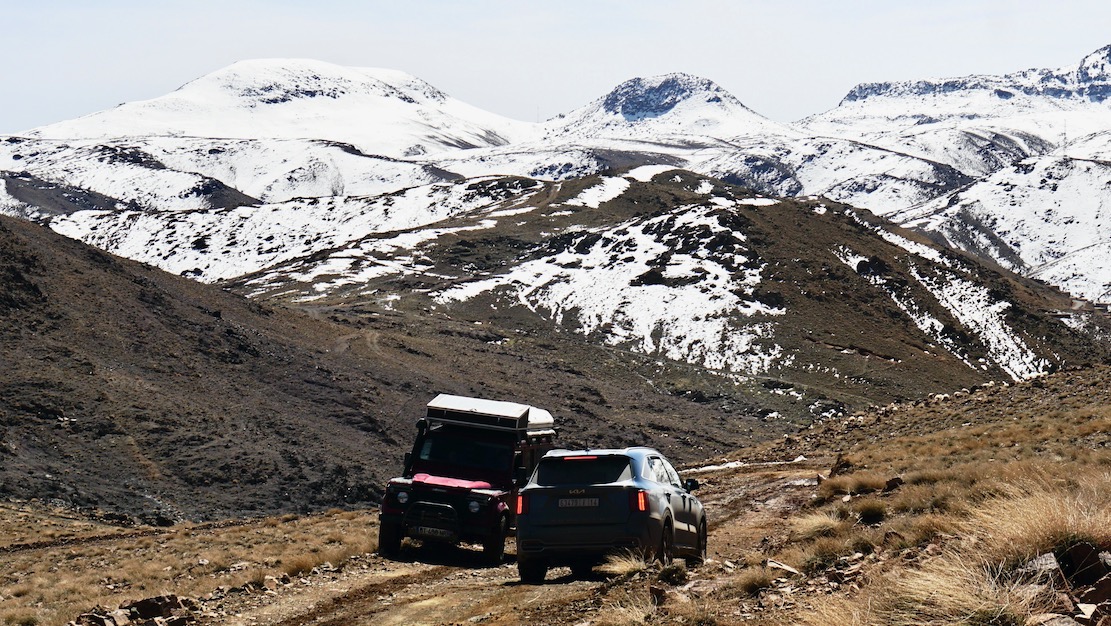
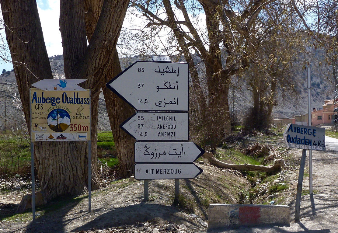
If you hit good trail conditions, as we did on our November 2025 recce and just before the worst winter for decades, the H.A.T can be completed in four very long days using overnight lodgings right on the trail. But away from each end, and near Aguim (H1), currently there are only two fuel stations. So, like parts of the TMT, motos with less than a 450-km range (ie: most of them) must rely on widely available village fuel. Details on the H.A.T map or ask in any village.
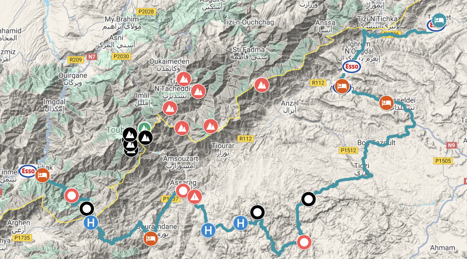
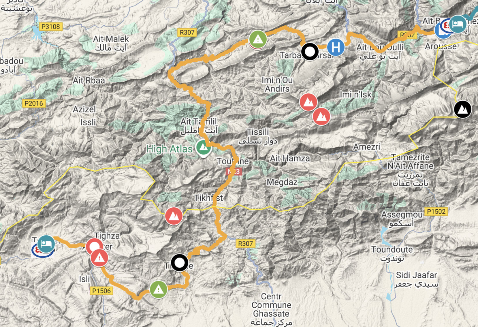
H.A.T stage by stage
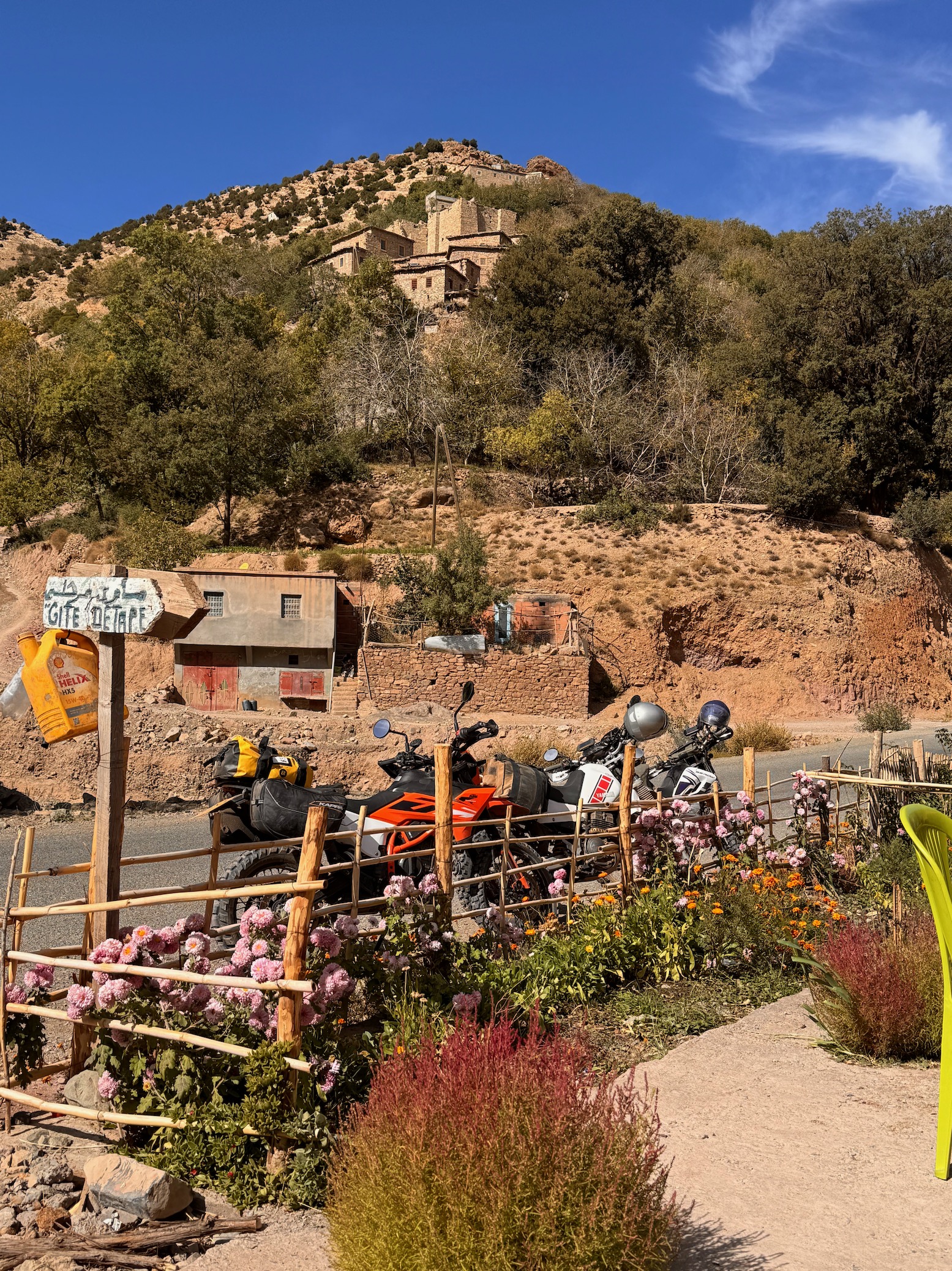
The HAT is primarily composed of four long stages meeting at fuel and lodging options. Short Stage 0 (below) can be run into Stage 1, making it fairly long day, but with only 25% piste and with lodging options before you reach the end at Telouet.
H0 • Tizi n Test > Talat • 37km
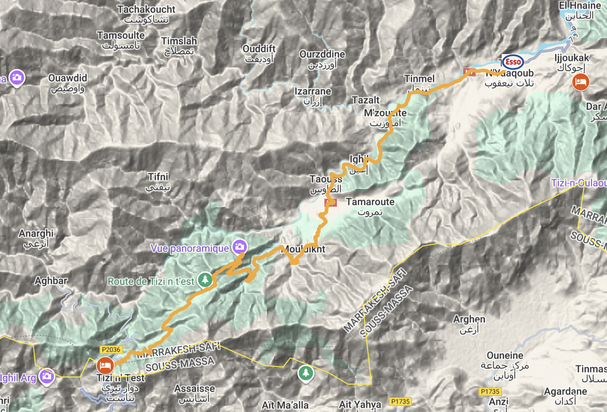
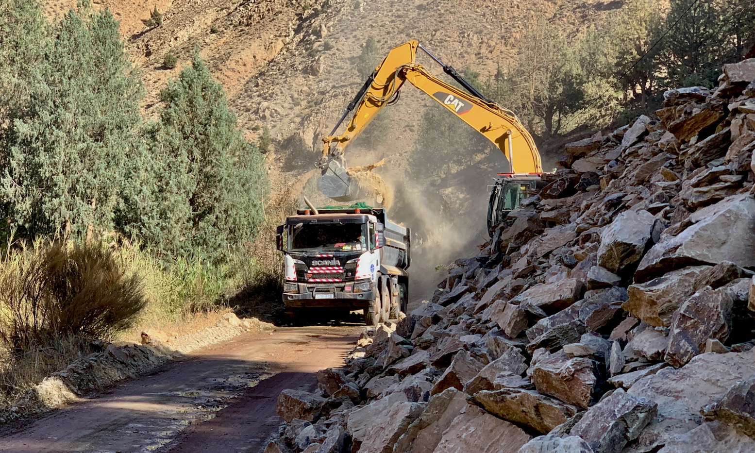
Kilometre Zero of the H.A.T is the 2100-m Tizi n Test pass on the N7 road linking Marrakech with Taroudant, south of the Atlas. There’s a cafe and an auberge at the col. Unfortunately, the twisting, narrow N7 is being widened on both sides of the pass, so while the 37-odd kilometres of H0 is currently unaffected, whether you’re heading south from Marrakech (then going back down), or are coming up from Taroudant or the end of the TMT, the N7 has loads of roadworks which can be off-roading of sorts. After storms rockfalls and landslides are common.
We assume most H.A.T-ers will be coming from Marrakech, so it’s up to you if you want to go up to the pass to KM0, maybe spend the night in the auberge and come back down – or choose to start the trail at H1: Talat n Yakoub fuel station near Ijoukak (auberges). If you’ve never been up the Test pass road, H0 is great run; one of the World’s Most Dangerous apparently, but there’s plenty more of that to come.
H1 • Talat > Telouet • 250km
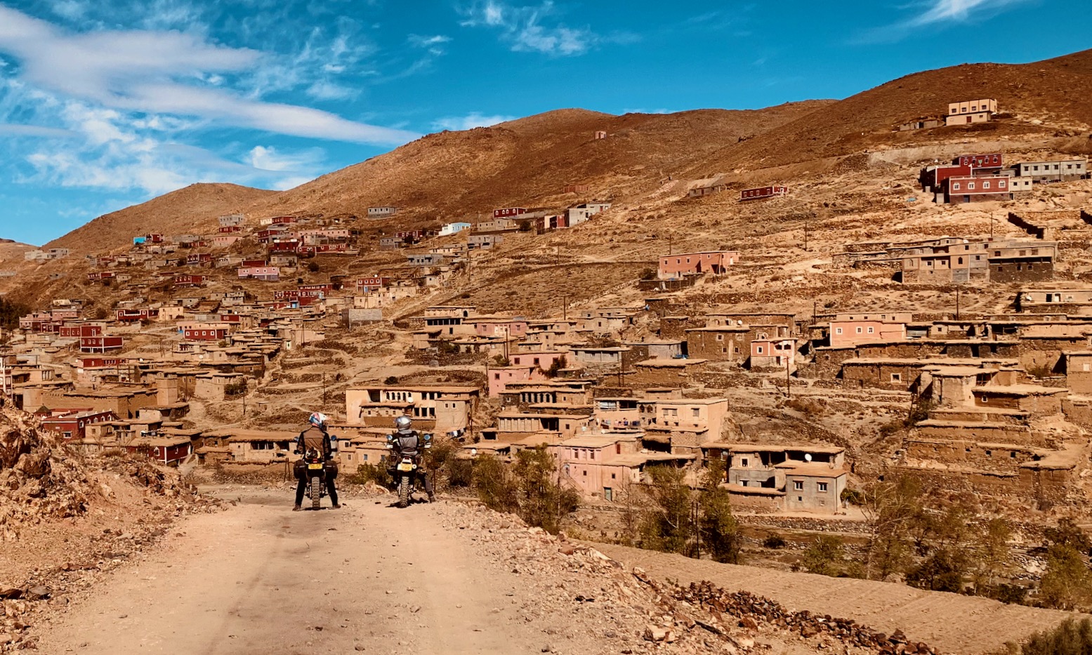
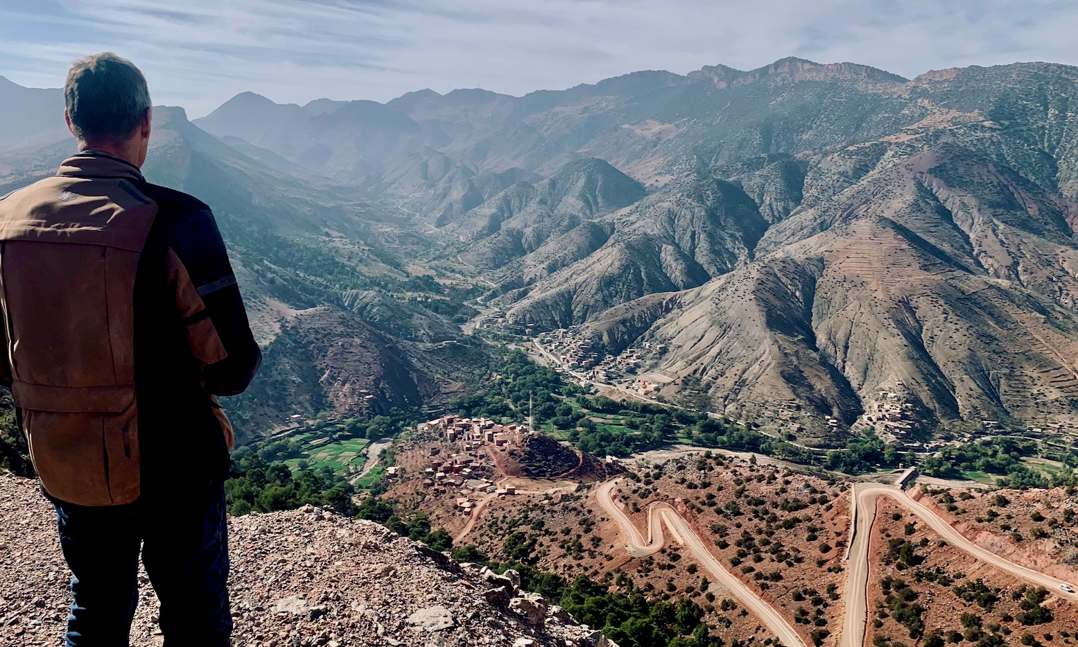
Tanked up at Talat, turn southeast up a wooded valley passing a few villages. The road climbs and turns to dirt, then ascends to the valley head and enters the ‘juniper zone’ above 2200m. Rejoin a crumbling road, top-out on a 2550-m ridge near a mast, then descend a long valley (below) with scenic Berber villages spread across the hillsides and Toubkal mountain (4167m) just 16km to the north.
Join the Aguim road near Igli (hotel/cafe/shops) and turn northeast for a short while. At a hairpin take to the trail, passing Anmid village, then get stuck into a steep climb to a rolling, 2300-m herders’ plateau, with snowy Jebel Sirwa mountain (3304-m) on the southern horizon. Soon take a thin turn east, another south at a blue sign. This rises up to another junction from where it’s east to Ait Qalla (below left; limited services).
Rejoin the road, then leave it for a roller-coaster run (above right) north to Ait Abdalla village. It’s all road from here to the N9 Ouarzazate highway, with fuel and lodgings around Aguim, then a right just before Tizi n Tichka for Telouet fuel station and several lodgings in town.
H2 • Telouet > Agouti • 195km
Soon after Telouet leave the road and work your way through Anmiter to the creek crossing. On the far bank the short, eroded ascent is no longer used by local vehicles. Big bikes and 2WDs may struggle but if you can make it up the switchbacks, you’ll manage the rest. The long way round is 130km via Ouarzazate.
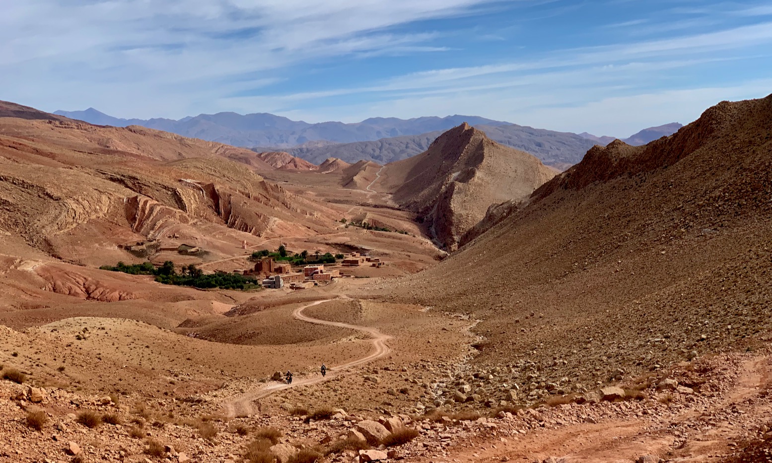
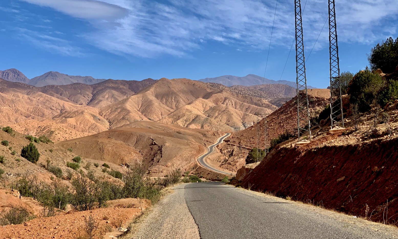
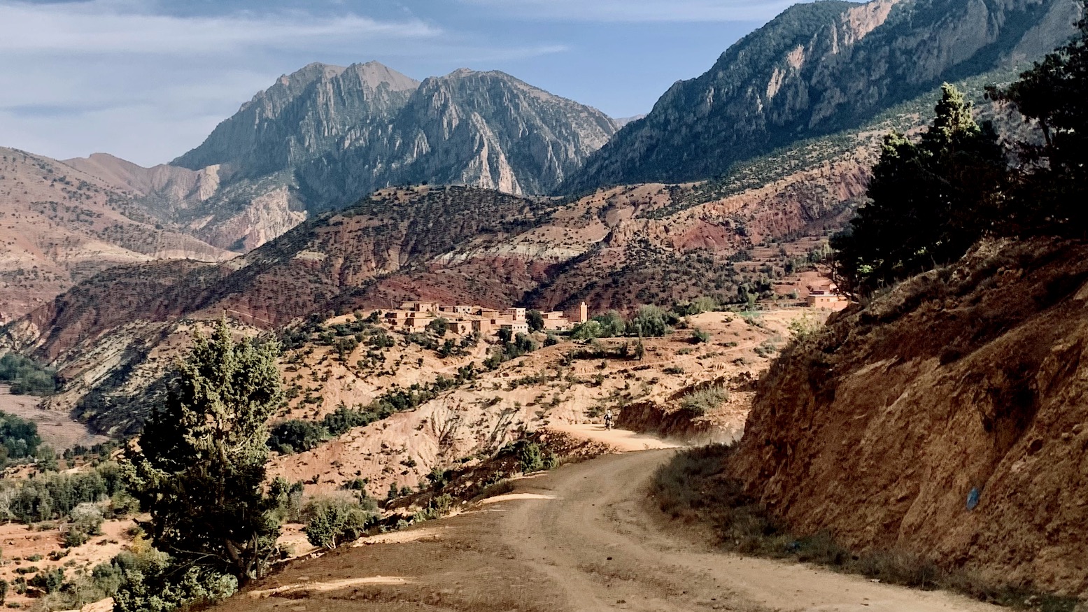
Once on top it’s stones, sand and bedrock for 20km to Tiririne? (above) where the track improves. Take a north for Tiliwine which leads to the badly broken N23 trans-Atlas Demnate road (road numbers can vary, map to map).
Soon after, you cross the watershed at 2180m and the road briefly improves, but not for long. Much of the N23 is being widened or rerouted and after years is still a mixture of broken old road, brand new asphalt or roadworks and dirt diversions. There are small towns and roadside cafes (above). At Col Azwin (2170m) you turn off down what’s left of the old, R307 (incorrectly marked N23 on some maps), mostly frost-mashed tarmac and gravel. At the valley bottom turn onto a newer dirt road all the way back up to nearly 2000m (below left). From here follow thinner village tracks over ridges and valleys. Few tourists pass through this area and tracks are little used by vehicles.
The distant rocky mass of Jebel Rhat (above right; 3169m) looms ahead. Note the stony stream bed Alert marked on the map. Soon after, cross a bridge where tracks improve. Pass through a defile and rejoin tarmac as marked on the map. That leads to an airy col at 2380m (below). Once down again turn right, the road leads through busy Ait Bou Ali, climbs up to Azilal junction, then drops into the Ait Bouguemeze valley, a long spread of hamlets and a popular venue for trekking with loads of lodgings. H2 ends at what will be the new fuel station in Agouti in 2026. Until then there’s nearby village fuel on the H.A.T map, one of many depots here.
H3 Agouti > Imilchil 245km
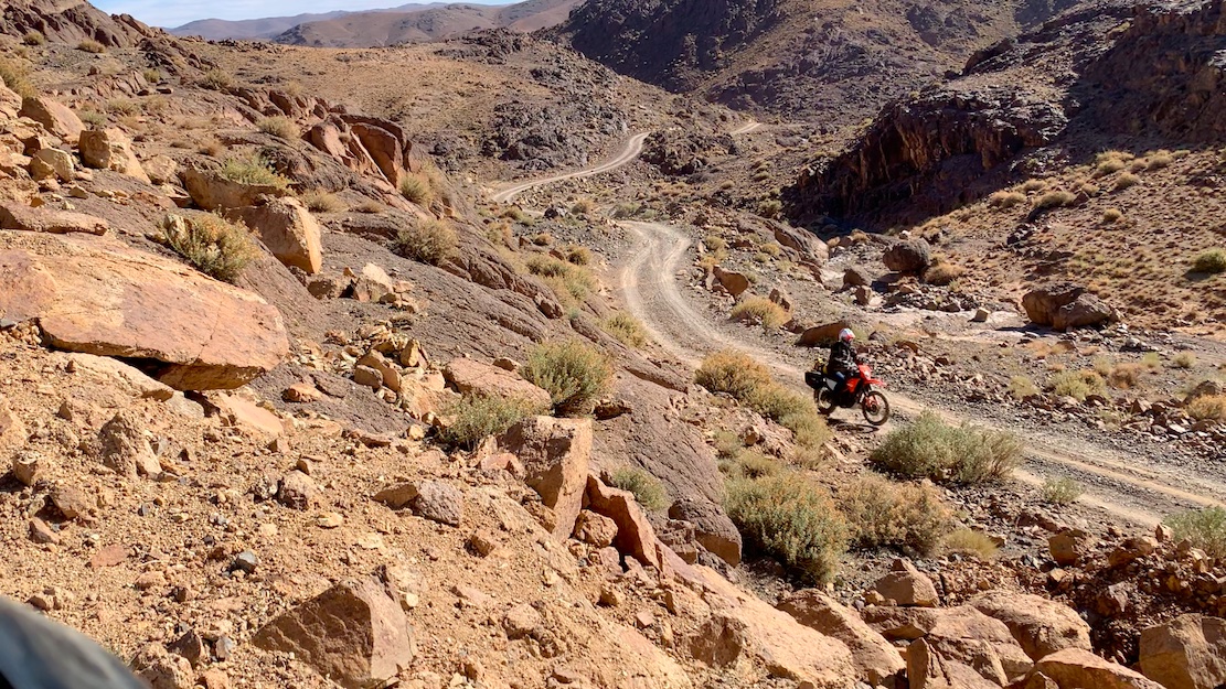
Things ramp up. If you’re scheduling your H.A.T stage by stage, this is a huge day with a whole lot of elevation so unless camping, make sure you’re up for it. Consider overnighting at the ultra-basic gite at Ism Souk (KM45; 2400m) one of Morocco’s highest settlements and where the real off-roading starts.
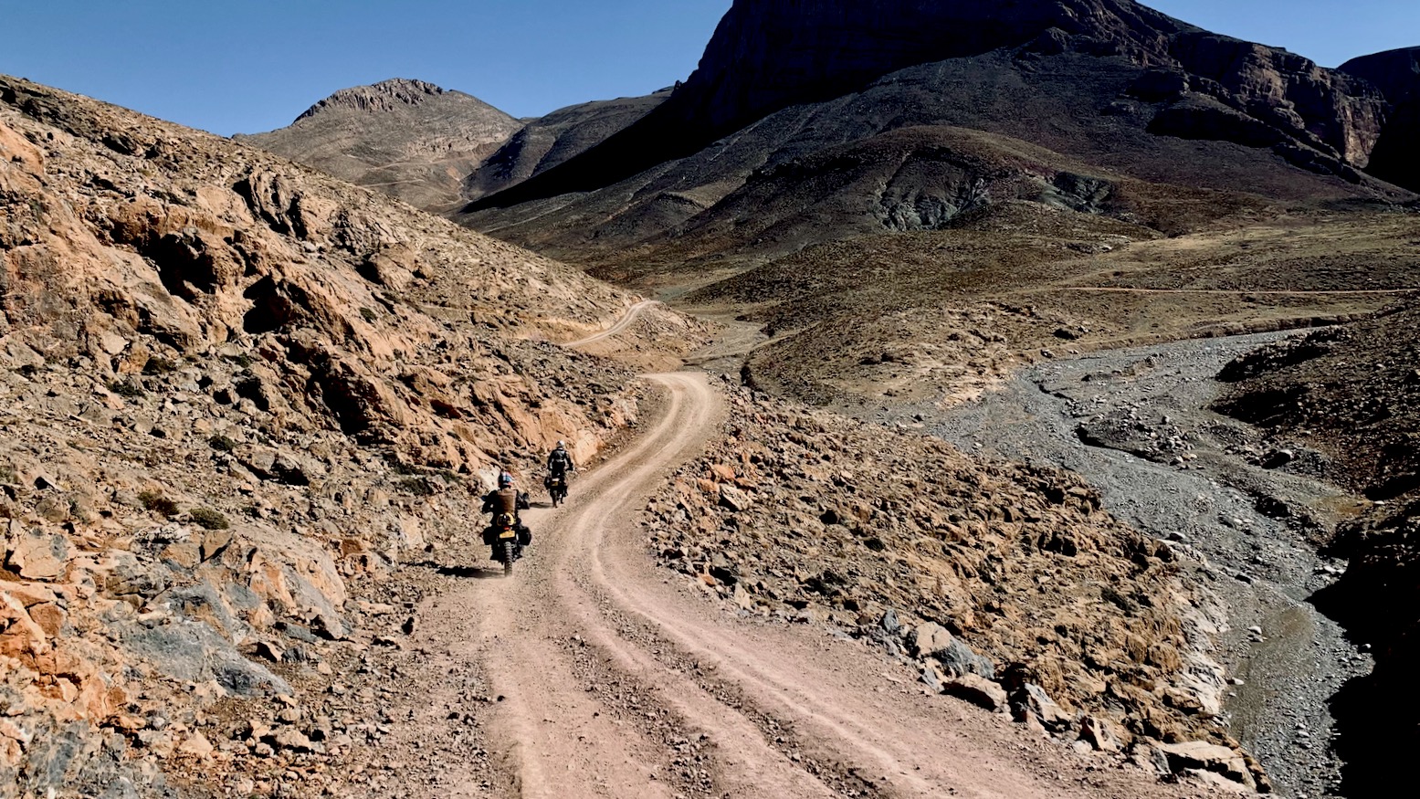
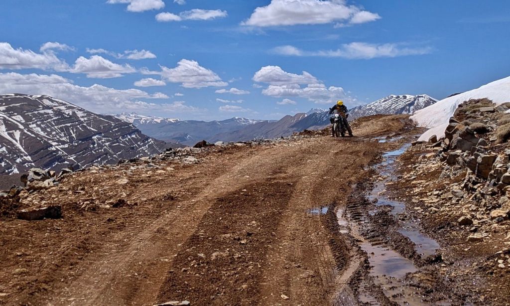
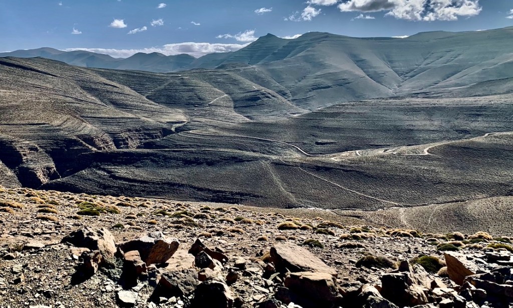
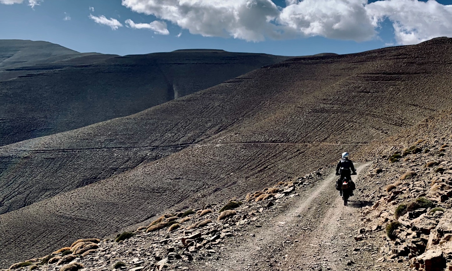
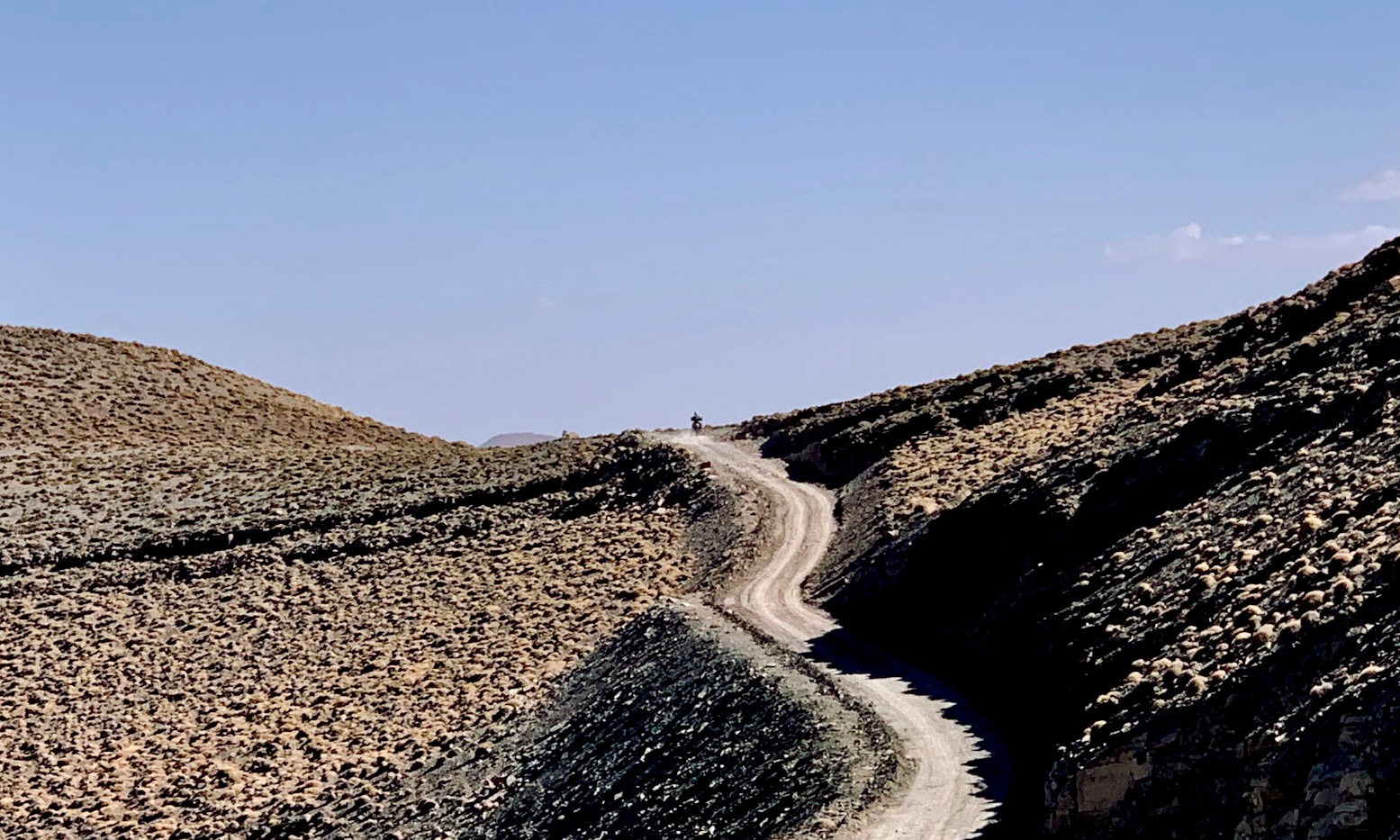
From Ism Souk a 65-km crossing (above) leads over the hills to the Dades valley. Half of this section is well over 3000m, making it the longest such piste in Morocco, if not all of North Africa. This stage may be snowed over until spring, so unless you know better, at Ism Souk ask: ‘Piste Msemrir – ouvert?’ while pointing up to the summits. If you’re at the snowline already (as we were in April 2025), it’ll be blocked up high for sure, with narrow trails, no snow poles and huge drops. There’s not so much as a rude herders’ shelter until you get to the far side. Remember, fresh snow is easy enough with the right tyres; thawed/refrozen ice on a slope is another matter.
If it’s snow-free and dry, the toughest part is the initial climb to 3000m. From here, as we found in November 2025, a Kangoo could get through, though a fortnight later it was probably all over for the season.
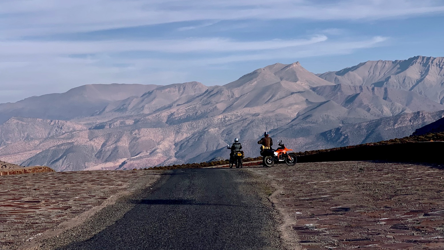
The track climbs gradually, contouring desolate scree banks up to the 3340-m high point where the long descent begins to the Dades valley. You’ll join new tarmac long before the R704 Dades road, awash with campervans and big motos.
This was just a taster. Up the road at Tilmi turn off the Dades road, climb back up to nearly 3000m, then drop down (refuge/pen at 2800m) into a hidden herders’ valley. Climb up the far side then descend gradually to Zerkane on the Imilchil road (shop). Follow the road down into a valley and up to Two Mast Hill (2690m). If you’re not camping, decide here if you reverse TMT-N to Bou Azmou (lodgings); less than two hours on a moto. Or, if short of daylight and energy, take TMT-NN road 33km directly to Imilchil (all services), also a great run.
H4 • Imilchil > Midelt • UNverified
We ran out of time to verify the last 95km of H4. It snowed literally the night we booked a flight and a rental, with much heavier falls forecast a couple of days later. The main asphalted passes get cleared quickly in the High Atlas (below), but most are relatively low and rise and fall quickly. Like the highest parts of Stage H3, the bleak, high-elevation finale of the H.A.T accesses no villages or anywhere useful and stays above 2500m for nearly 40km. Clearing this part of H4 will be left to the next thaw which may be a while.
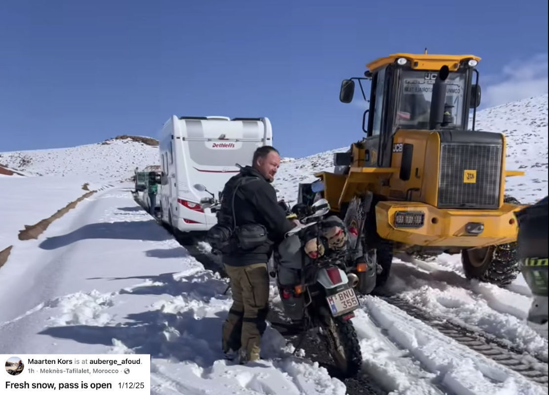
A month later much of the High Atlas was still snowbound
The first party to submit a clean, annotated tracklog of H4 from station to station will be credited with completing the H.A.T project. Fancy it? Then read on, but as said, do not put yourself at risk and know when to turn back. Otherwise, we’ll be out there in the spring to finish the job.

From Imilchil the verified part of Stage 4 was last run in February 2024, and starts easily enough, following a well-used but frost-ruined mountain road rising over 2600-m past several villages including Agoudim (KM76) with a few basic auberges. If you want to have a crack at what remains, consider spending the night here for an early start; the last known lodgings on H4 until Midelt.
The verified section ends soon after Agoudim at KM83 junction. A road or track continues east along the valley floor to Tarart, the last village at KM105 (2120m). Beyond this point floods and landslides streaming off Jebel Ayachi (3750m, just 6km to the north) have washed away the trail in several places. As this isn’t a pylon route nor leads anywhere useful, there’s little incentive to maintain it so when necessary, navigate ground to map, ie: the least hard way ahead, not where the tracklog suggests. You reach the ‘South Col’ at 2910m, soon followed by Tizi ou Adil, 2970m where a thin spur leads 17km west to the summit of Jebel Ayachi (3750m). This is not part of the H.A.T. In 2025 I heard of Land Rovers and bikes reaching Ayachi summit, but all will struggle on what remains of the trail. You’ll find Ayachi tracklogs online.
Continuing along the H.A.T, you cross Stage 4’s 3020-m high point and reach a junction where the main trail drops down to the Oued Hamza riverbed, prone to landslides and other blockages. If you need to get off in a hurry, it’s 16km to a road and the RP7012 for Sidi Hamza (lodgings). Otherwise, continue climbing along the trail less travelled, working your way northeast towards the 2900-m watershed of the Jebel Ayachi massif. A track comes up from the RP7012 but you turn north and descend, navigating around washed-out and diverted trails to Midelt (fuel; lodgings; shops). From Midelt it’s 400km to Nador.