Updated March 2026
The Trans Morocco Trail and High Atlas Traverse (H.A.T) are like the TET in Europe or BDRs/TAT in the US: a series of free-to-download tracklogs (lines to follow on a digital map) with some essential points of interest (POIs). Suited to motorcycles, 4x4s and gravel bikes/MTBs, additional preparation and logistical arrangements will be essential.

Whilst the purpose of the TMT and H.A.T are to help you explore the brightest and best Morocco has to offer by bicycle, moto or car, our navigation resource should not be viewed as substitute for personal responsibility and additional research. Only you know your technical, physical and mental capabilities (or will soon discover them) and so are able to determine whether the TMT or H.A.T are for you. These FAQs are pitched towards motorcycle riders who seem to be more active on the Trails but unlike a 4×4, also have more to lose if they misjudge things.
- Read loads of user feedback on the TMT FB page
- More information on the Morocco HUBB
- More still in Chris Scott’s Morocco 4 book (below), and on his
Morocco Overland website, which includes:
How hard are the TMT & H.A.T?
Like Chris’ Morocco guidebook, we did not devise the TMT or H.A.T to break you and wreck your vehicle. Our priority is to help you safely explore the amazing Moroccan wilderness and Amazigh culture without getting freaked out, but severe weather messes up formerly easy stages for months after, in some cases requiring diversions. You need to be ready for this and prepared to turn back or deviate.
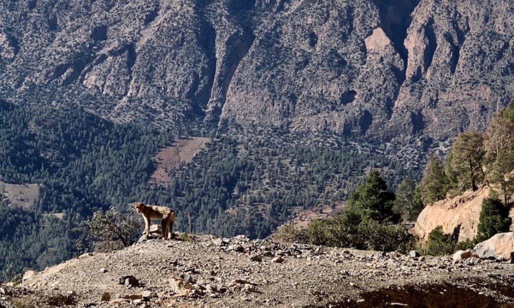
In our travel experience, navigating trails and backroads is a great way to have an adventure. These byways are nearly all regular ‘market roads’ used by locals on everything from a mule, a Chinese scooter (above) or a jacked-up Mk1 Ford Transit village bus. But all unsealed roads are prone to storm damage and degradation, and a few stages of both routes are barely used by local traffic.
What’s the best time of year?
Like the planet, year on year Morocco experiences more extreme weather: record levels of heat followed by intense floods dumping a year’s rain in two days or massive snowfall in the mountains. November to March are best for the TMT, unless you don’t mind 35°C+ in the south and springtime rains.
For motos, heat in the desert is the issue, although sudden flash floods can inundate roads and tracks, and wash away bridges before water levels quickly subside, revealing the wreckage. This can happen in distant desert regions even if it’s not raining. If these roads and trails access villages they get repaired quickly. If not, they’re abandoned and another way round is found.
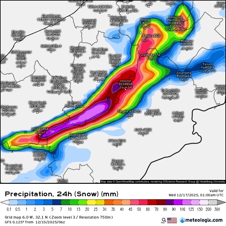
Mountain snow (above) is less of an issue: it’s obvious and routes are either open/passable or they’re not. The H.A.T never drops below 1500m (5000′) and has days reaching over twice that elevation. We think trying the H.A.T from October to whenever heavy snow settles over 2500m is the best time. That could as early as December (as in late 2025) to February.
Many choose to visit Morocco in Spring, but the weather is temperamental, flitting between heatwaves, downpours, strong winds and mountain snowfall. Cars with a/c are fine; bikes are more vulnerable. Read this HUBB thread which gives lots of real-world advice on managing high temperatures.
To repeat: on a moto, even on the H.A.T don’t get worked up about mountain snowfall (watch the forecast then layer up, turn back or wait). It’s straying into the desert heat with escalated water consumption that will get you when your moto becomes exhausting to handle.
What do the stage colours mean on the maps?
Both routes are made up of stages which are coloured alternately simply to clarify one from the next. Broadly speaking, a stage goes from one fuel and lodging place to the next and is doable in a day. But you may be faster or slower and might manage two stages or more TMT in a day, especially out of Nador. H.A.T stages are longer, and fuel’lodging options are limited.
Some stages on both Trails are less than 20% off-road, a few are 100%. For all sorts of reasons, some days will be harder and longer than others. The TMT and H.A.T maps have more details.
Think twice about tackling remote desert or high mountain stages alone with an inappropriate machine when it’s forecast to hit 35°C + in the desert with strong winds – or torrential rain and heavy snow in the mountains of the H.A.T. And whether you follow this advice or not, know when to turn back or find an easier way around. Tracklogs are just a line on a map, and like maps, they cannot depict the terrain, track surface or the current weather.
How can I tell which are the harder stages?
Many older or inexperienced riders on big bikes ask this. Each stage on the TMT and H.A.T Master Maps has a short summary, including the approximate percentage of trail/road. Study the map carefully. One or two TMT desert stages like TMT-K or TMT-S have sandy ruts where riders can struggle on a big, heavy bikes with inappropriate tyres. The H.A.T has high mountain transits where snow, mud and landslides may slow things down in winter and spring.
The TMT and H.A.T maps also have an Alerts layer. Click the red warning triangle (as shown above) for more info. Most tracks in southern Morocco are rocky which giant Adv motos can soak up a straight line, but become a handful when negotiating steep, loose switchbacks or stony river beds.
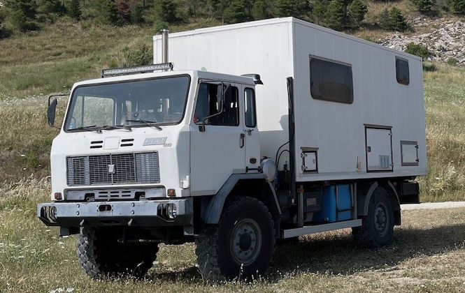
Will my 10-ton truck manage?
Due to overhead rock clearance and track width/drop-offs and sharp turns, parts of some mountain stages will be unsuited to 10-ton, 3-m-high AWD camper trucks, as above. These stages include:
• Stage A from Nador
• Stage P Assif Melloul gorge west of Anergui. Overhangs/narrow tracks above the river. Backtrack south to 31.9241, -6.0104 junction then turn west to rejoin P
• Stage T after road’s end at Mawas (30.26954, -7.21444) has some tight switchbacks. It’s unlikely this section will get widened and made into a road to connect with Issil
• Much of Stage U will have tight bends and narrow tracks over drops until Timdrart. And the spectacular descent to Aguinane has some very tight bends alongside big drops
• Stage V may be a tight squeeze out of Ait bin Yakoub (30.03835, -7.93677). If you can do that, you’ll manage the rest to Tata
• The Tizerkine gorge on Stage W is improved up to Mezdak, Beyond there to Ifesfas rock width markers on the track sides specifically exclude anything bigger than a Sprinter. So way back at 29.64533, -8.42199 take the Akka gold mine piste (W4 in the M4 book) to rejoin W east of Afella
• Tight switchbacks on every H.A.T stage bar H0.
How long will it take to ride the trails?
We hear the TMT’s been done in ten days, and some motos can bang out three stages in a day. But most will struggle to cover the 3250km in less than a fortnight, and cars usually take their time. Only you know (or will discover) a pace that suits you, but many first-timers in Morocco overestimate what they can manage in the time they’ve given themselves. The H.A.T is doable from four long, hard days. Six will be easier.
I’ve never been to Morocco & don’t have off-road experience. are the TMT & H.A.T for me?
No, especially if you’ve never travelled abroad and go alone on a machine you cannot pick up. The combination of culture shock and off-roading in remote corners of North Africa will produce a steep learning curve, as it did for Chris in 1982.
Ease that gradient by first trying some local TET trails, flying into Morocco to get a rental, join a tour or go with others. As said, one mistake first-timers commonly make in Morocco is plotting an over-ambitious schedule.
can I leave my vehicle in Morocco & come back later?
Yes, for up to 180 days in a 12-month period. Chris has used this arrangement for the last few years, coming down in the autumn to ride a week or two at a time, then ride home in the spring. You can leave your bike anywhere. Near an airport makes sense or at any amenable auberge. You will need your white TVIP vehicle import card. Full details here (see most recent posts). Note: you may need to reinsure your machine on your return; more on the link.
Does tmt have to be done westbound to the atlantic?
No. Like many established trails, it was conceived in one direction but is entirely reversible. With the TMT we decided that ending at a wild Atlantic shore would be more satisfying than the ferry port at Nador.
Same with the H.A.T but more so. It’s been logged eastbound from near Marrakech, and gets progressively higher each day. If you’re up for it you could do TMT out and H.A.T back. There are all sorts of ways to mix up both Trails.
what’s the best way to meet other riders on the TMT?
If you’ve an overlander you’ll know how easy it is to team up with others for mutual support ahead of a sketchy section. That’s unpredictable of course, so scan the TMT Facebook group and announce your plans there. Many riders have successfully done this.
There are a number of natural meeting points on the trail where you might like to meet other TMT-ers. If you’re heading out to Stage I and are a little nervous about tackling the desert sections solo, special mention goes out to Chez Francois, a campsite with simple accommodation and a restaurant at Boudnib. Located at the end of Stage H, this has become a favourite rendezvous for TMT-ers.
On the H.A.T you’ll meet who you meet, but the gnarlier eastern stages are best not attempted alone.
Do I need to book a ferry to Morocco?
At least one ferry leaves each day from Malaga, Motril or Almeria to the Spanish enclave of Melilia or the adjacent Beni Enzar port of Nador: the start of the TMT. Because many run overnight, after dashing across Spain you might want to sleep in a proper cabin, not a back-breaking chair or on the floor, so it’s advisable to book ahead. Read about Ed’s experience from Almeria.
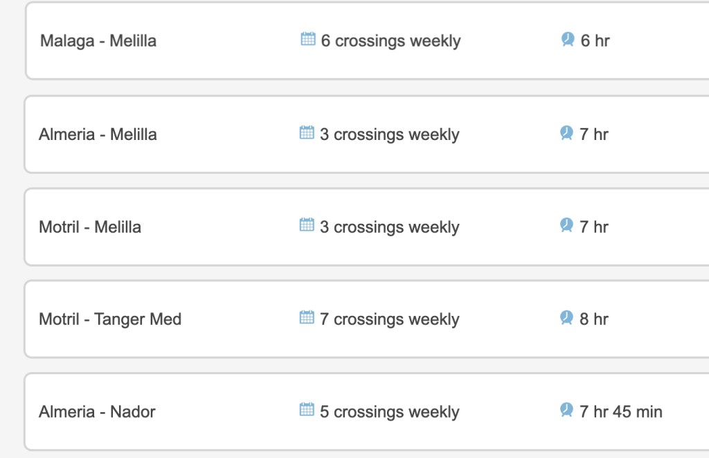
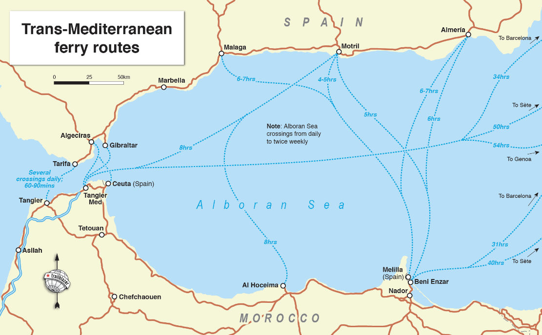
Further west, from Algeciras (Straits of Gibraltar), ferries from four or more operators leave every couple of hours so there’s always room and booking is unnecessary. Note they never leave on time, but only take about an hour to cross to TanMed.
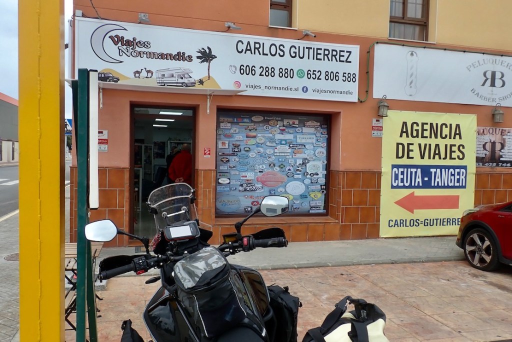
At Algeciras you can buy tickets for the next sailing from the ferry operator counters in the port, although for many years the Viajes Normandie ticket agency (below) has sold inexpensive tickets for cars or bikes, plus gives you a free bottle of wine and a cake. Open daily 9am–9pm; see the TMT Map. From Viajes to Algeciras port is a well signed 6km and Malaga with ferries to Nador is 130km in the other direction.
For the H.A.T, KM Zero is 710km from TanMed port (85% toll motorway) and three hours south of Marrakech.
can I rent a decent moto or 4×4 in Morocco?
Yes you can. Chris worked with Loc2Roues (aka: BM Attitude) in Marrakech for over a decade, and has also rented from M2R and other outfits. There are many more moto rentals in Marrakech now: See this HUBB thread or this TMT post.
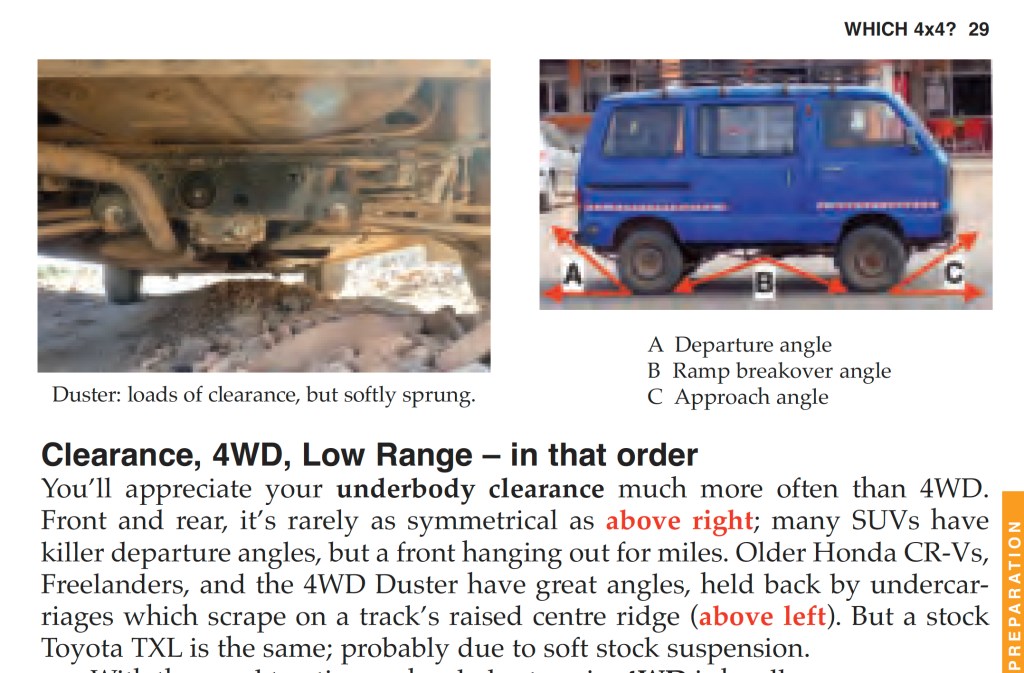
Chris has also rented 4x4s from Medloc in Marrakech on several occasions. If you know what you’re doing you might manage in a light and economical, Moroccan-built Dacia Duster SUV. If you’re less experienced with reading terrain off road, cough up for an automatic TX Land Cruiser.
The problem with rental cars is that there’s usually no equipment for recovery or repairs, or it costs extra, plus with bikes or cars, their understanding of ‘good tyres’ may not match yours. With a moto rental, also verify whether tubed or tubeless (latter much better), then bring (or ask to borrow) the means to repair punctures. With a car verify there is a working jack and a usable spare tyre. Any town with a few shops will have a tyre repair place.
What documents do i need to enter morocco?
- Passport (most visitors don’t need a visa and can stay for 90 days)
- Vehicle ownership document (‘V55’ in the UK) in your name or with a covering letter
- Motor insurance covering Morocco. If you can’t get it back home (as with most Brits on motos) buy at or near the port, see below
Not essential but advisable
- Driving License. Only asked for with rentals. No one in Morocco will ever ask for an International Driving Permit (IDP) or even know what it is
- Travel insurance. Needs to cover you for travelling off sealed highways which are still regular vehicular rights of way. From £30/week
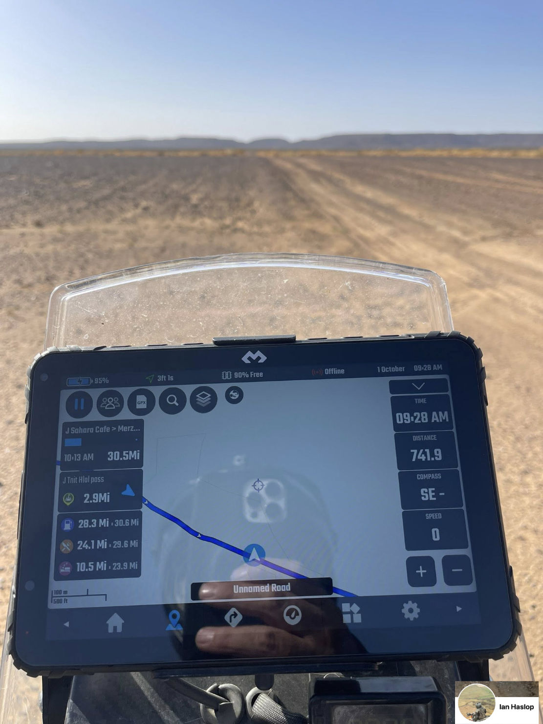
What maps & APPS do you recommend for nav?
All about Maps.– paper and digital and online. You will need a map on your device to display the TMT tracklog, ideally something better than Google is rubbish and inaccurate in Morocco.
If using a device like a phone or tablet, download a proper mapping app – you may have to pay/subscribe for full features. Many on the TMT FB page rate OsmAnd. Mapy.com and GaiaGPS are other ones with unusually good background maps.
If you use a dedicated satnav device like a Garmin, download a free Morocco OSM map into the correct folder of your unit. Then download the TMT/H.A.T gpx files into the unit which will show up on the map.
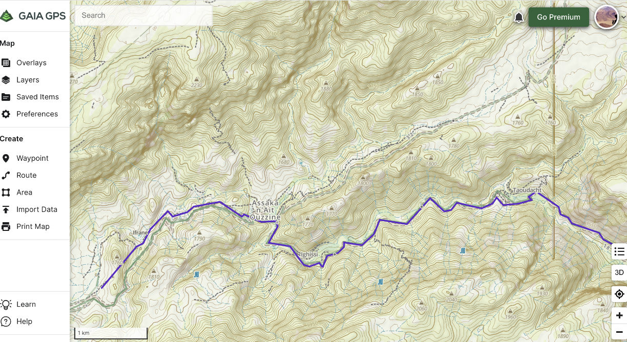
how do i use the tmt and H.A.T maps?
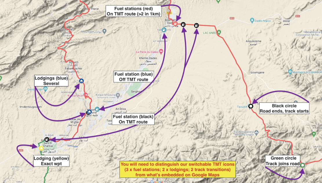
Both the Trans Morocco Trail and High Atlas Traverse are Google My Maps embedded on this website. They’re nice to look at and good for planning and the latest versions are always online to refer to, but otherwise that’s it. Note the map version (v2.64 and so on) as we regularly update.
The gpx file of the latest version is linked off each map’s sidebar intro and is what you want to download and import into your device. The TMT/H.A.T Google maps show essential info at a glance:
• tracklogs of the stages in alternating colours
• fuel stations on or near the Trails
• lodgings
• where asphalt starts / ends (see below)
Note: other information from Google like place names, road numbers, POIs and so on are famously unreliable in Morocco, especially the user-generated clutter. All TMT data is verified and reliable. The last 100km of the H.A.T is mapped but is yet to be verified.
do the TMT & H.A.T follow public rights of way?
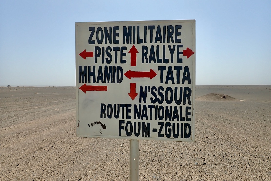
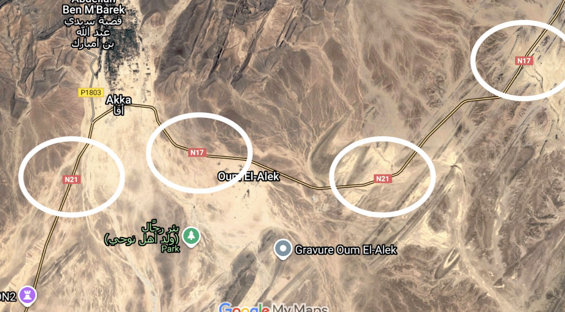
Yes. In Morocco most tracks and all roads are designated under Morocco’s road classification system from ‘N’ for national highways down to ‘RP’ and ‘PP’ (provincial tracks). There are masses of tracks, new and ancient, linking places which you can either reach or you can’t. Tracks may divert around blockages (usually flood debris or landslides) or new cultivation. They also become semi-abandoned when new roads find a better way round. Others derive from prospecting or mine sites access and become abandoned, or head into restricted military border areas.
On uncultivated or barren land (most of the TMT and H.A.T; as above) you can ride wherever you like, but most of the time – and certainly in the mountains – there is one clear track. At some blockages like rockfalls, light bikes might get through where cars may have to divert or turn back. In flatter desert regions (Stages K and S, for example) tracks go in all directions which requires closer attention to the nav.
Note that in 2018 Morocco renumbered many roads. See this thread. The important thing to know is that road numbers hardly ever appear on roadside road signs (as they do in Europe, for example), and that for some reason Google Maps remains the only mapping platform to ignore this new numbering (unlike rivals: Bing and OSM) or even introduce errors like the ‘N21’ – the N17 border highway (now they include both numbers; below). So expect confusion with mapping with Google, but not so much on the actual road.
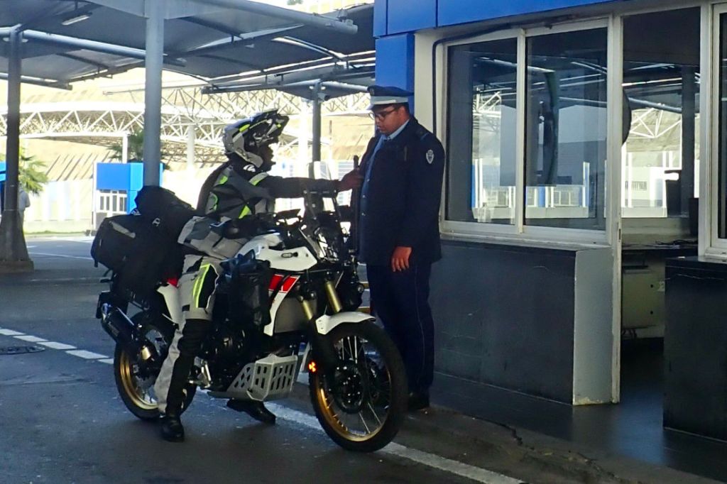
Is it safe to do the TMT or H.A.T alone?
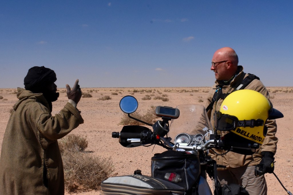
Not really but people do so anyway, including Chris and Ed and many TMT and H.A.T users. Have a quick read of this blog by Ed, which pulls together his experience of solo adventure motorcycling around the world. Solo will never be as safe as doing it in group, but plenty of people do so, accept the risks and have a great time. Clearly you must handle yourself appropriately, factoring in remoteness, exposure, weather, fuel, water, ninja ambushes and all the rest.
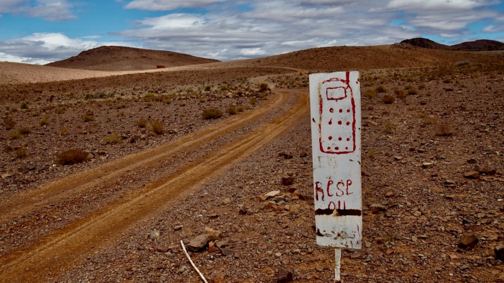
These days the most useful safety device is a mobile phone, plus knowing who to call. Doing so will be far more effective than firing off your InReach SOS or SPOT: this should be a last resort. If you don’t know anyone out there, take the number of your lodgings (some places even offer). Phone reception in remote Morocco is far superior to similar locales in the UK, for example.
Using your home phone number abroad can incur a daily fee but a Maroc Telecom PAYG SIM card costs next to nothing and can be topped up at any village shop (ask and they’ll do it for you). Straight away, slap 100dh (€10) on for calls/SMS, and another 100dh of internet data. You’re now good for a week or two.
Few of the TMT tracks are that long or remote, and in the cooler season will see daily traffic. The real danger is misjudging the desert heat once physical effort is involved (pushing, digging, picking up, inner tube repairs) at which point water consumption rockets. On the H.A.T heat stroke is unlikely but there’s chance you get stuck up high overnight on a track that’s barely used.
can the TMT & H.A.T be done in a regular car?
Yes, provided it has good clearance underneath the body and at each end. Unfortunately most modern cars, even many SUVs, are not like this, especially at the front. All-wheel drive traction is rarely an issue on dry, firm tracks. But when you need AWD, you need it.
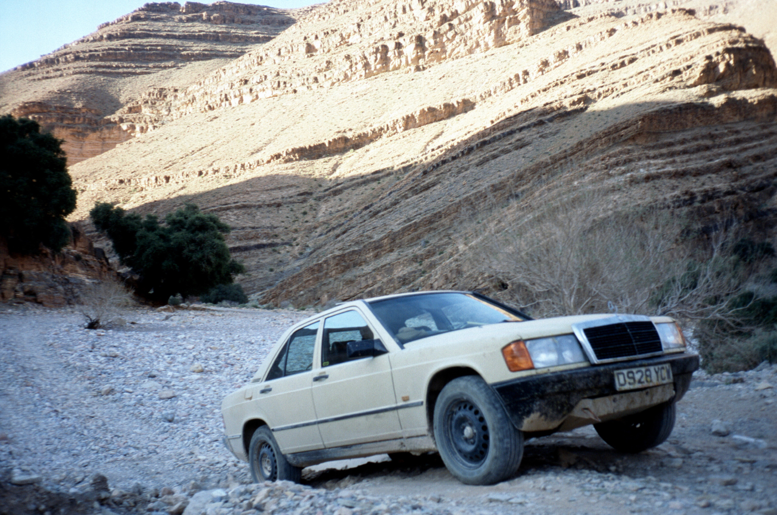
Read about Chris’s experiment off-roading in Moroccan with a jacked-up Mercedes 190 many years ago. It managed better than you’d expect – until it didn’t. Below, the Smouguene valley of Stage W when it was all one long river bed.
What is the max fuel range needed on the TMT?
Some Stages are 350km, station to station; on the H.A.T it’ll soon be 250km. But both Trails pass through villages where shops sell fuel by the 1 or 5L bottle at a mark up. This fuel is the same you’ll get at a station.
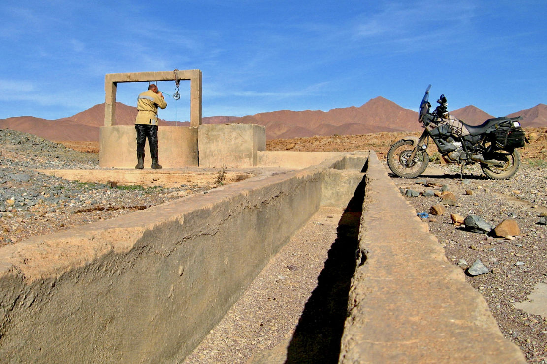
What about water?
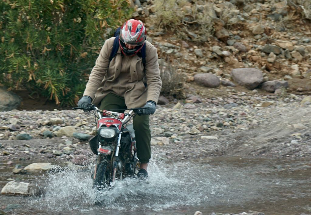
Also available in bottles from village shops, as well as municipal village taps, and from trackside wells (below) or mountain springs. Tap water is fine in Morocco, except in places like Foum Zguid, the Atlantic coast or Anergui where the groundwater is salty.
How frequent are lodgings on the TMT and H.A.T ?
See the master maps: blue = several in the area; yellow IDs a single verified place. All known lodgings along both Trails are marked (there will be others) and none are more than a day’s ride apart (~200km). Just about all are embedded on Google Maps anyway, and many are also on booking.com. Chris finds this the best hotel booking app for Morocco and which can be cheaper than walk-in rates.
What are these lodgings like?
Away from the busy tourist areas (Chebbi, Zagora, Dades) the choice is limited on the TMT and what’s offered might be basic but will be clean, comfy and with great food and wifi (though your mobile data is usually better). Be wary of anything too flash, with staff dressed up like pantomime Tuareg – you may get less than you pay for. In most places ask for half-board (dinner, bed and breakfast or ‘demi pension’) from around 250dh, because there’ll be nowhere else to eat, except in some towns.
IS THE PARKING SECURE AT THESE LODGINGS?
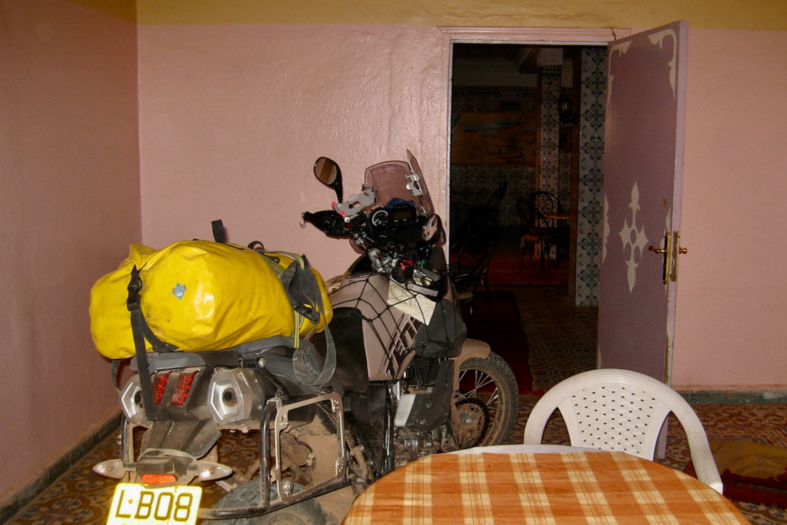
Yes, but as anywhere, be as streetwise as you’d be anywhere abroad on a clearly foreign machine. Motorcycle theft is virtually unknown in Morocco, but pilfering will happen and most places along the TMT will offer secure, off-street parking for motos, including right inside the building, in a courtyard or watched by an overnight guardian (who might want a tip). Or they’re so remote it doesn’t matter.
As a first timer, after a few days you’ll get a feel for Morocco, security and your lodgings and become more relaxed. Nevertheless, unless you know better, we advise removing or emptying your luggage and any other items which would be inconvenient to lose. Certainly do this in a city street, or anywhere when the bike is visible overnight to passers by. Then, indoors or out, cover your motorcycle. Under a cover (below right) it’s less interesting.
With a car the same common sense applies: stash easily removable items on the vehicle exterior, don’t leave any items on show inside, then lock it up – especially roadside and even more so in a city (which both routes largely avoid).
Do they speak English in morocco?
In the tourist areas (Chebbi, Zagora, Dades) younger people will speak English, but French will be much more useful overall and is understood by older folk. In remote hamlets villagers won’t even speak French, except perhaps older men.
Are bank cards or payment apps widely accepted?
No. Some bigger fuel stations in the south take cards now, as will some flashier lodgings (with a fee). Change cash on arrival and top up from ATMs where you can find them. Bring a few cards for ATMs as not all foreign cards may work.
how much money do I need per day?
The Moroccan dirham (MAD or dh) ha been about 10dh to the euro for years. Pre Iran war, petrol or diesel are 11-12dh a litre (more from villages by the bottle). Rooms cost from 250–500dh per person half board. Pay more than 500dh and you’re usually wasting money. A roadside tajine (stew) or brochettes (kebabs) from 30 to 70dh. Bottled water is 5dh for 1.5L Puncture repair from 5dh. Budget from €50/day accommodated, much less if wild camping.
will moroccan diesel agreed with my modern engine?
Yes. Moroccan diesel has been on a par with European ULSD standards since 2009, but you might want to bring a stash of AdBlue.
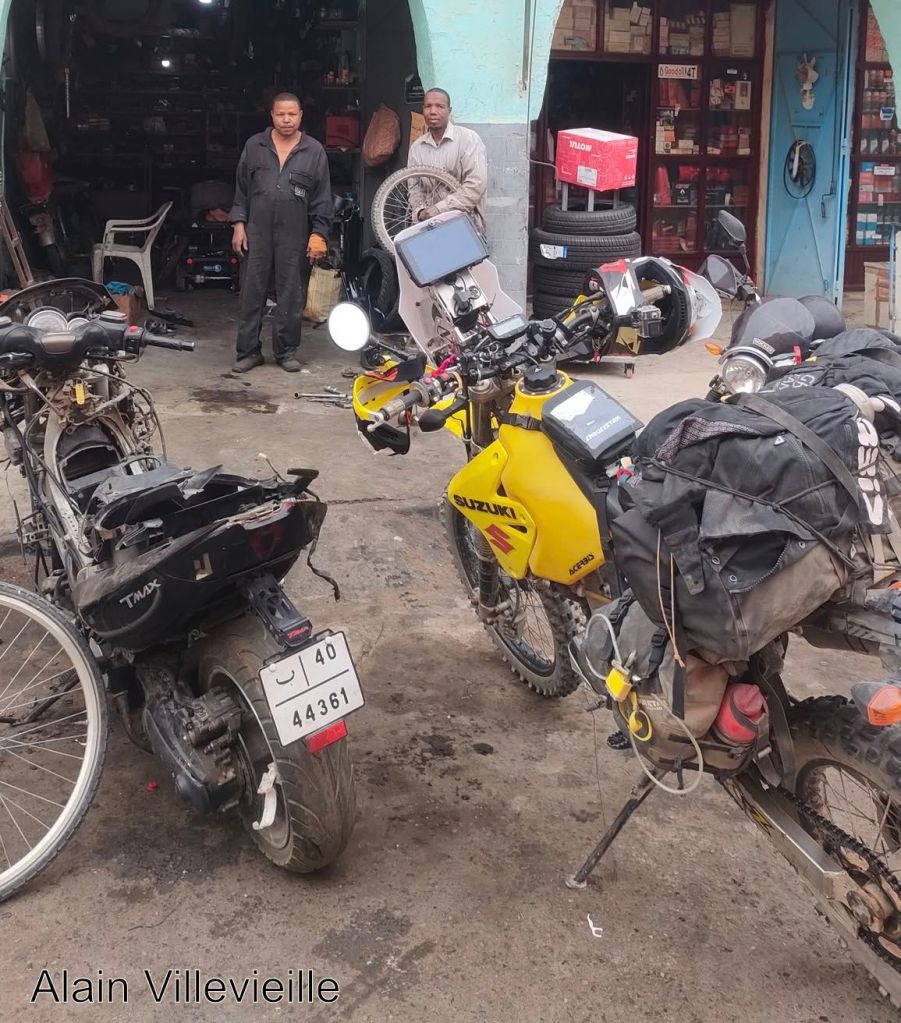
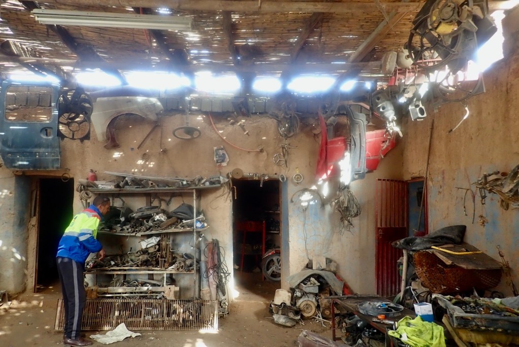
what are the bike & car repair garages like?
It may be different in the northern cities, but down south they’re rough and used to keeping old bangers running. Whatever bike you’re on will probably be unknown in Morocco and the chances of finding a fat 17″ inner tube for an Africa Twin are slim. Moto chains and tyres are a bit different: try rental places in Marrakech or Ouarzazate and repair shops in Zagora. Motoplus in Casa is regularly mentioned, but it looks like they merely supply consumables like tyres, chains and batteries. Bring spare tubes or go tubeless, like all cars since decades ago.
Older Land Rovers and Toyotas may be better off. Every town will have a tyre repair shop who’ll do the hard work for you and as mentioned, Zagora is good for repairs.
Because of this scant support it would be foolish to leave for either trail without all part-worn parts renewed and without the tools and know-how to perform basic repairs and bodges.
Are there easier bypasses to the stages?
Yes. Study the TMT and H.A.T master maps: there is always a way round or a short-cut by road, as well as recommended diversions, although on the H.A.T the long way round may be very long. Enjoy blasting along deserted roads if you’re behind schedule. Make the Trails work for you, not the other way around.
Are more challenging or technical routes offered?
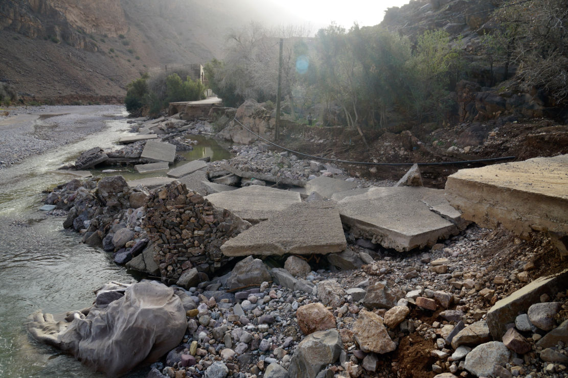
No, that’s not what the TMT or H.A.T are about because bad weather can soon give you all the challenge you want. The Morocco 4 book has thousands of kilometres of detailed route descriptions either side of both Trails, which are as good, but not much harder. Note that any route can become more challenging in a dust-, rain- or snowstorm, or as a result of the landslides, wash-outs, electro-magnetic pulses, and missing roads or bridges which follow such events. Flash floods wash away the compacted track surface down to the gnarly bedrock, or funnel ruinously down to the lower valleys, resulting in widespread devastation, as below.
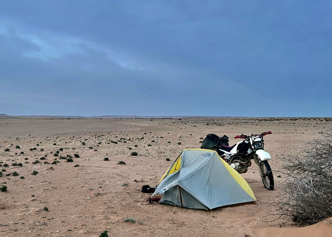
can i wild camp on the trails?
Of course. There are no restrictions other than common sense and privacy for you and locals. You’ll pass countless great spots along the Trails. With a car it’s a great idea but on a moto it’s a lot of extra clobber to carry when you can pay from just €25 half board and lounge around, bathed in wifi, cushions and fragrant cooking aromas. Snakes and scorpions are only a camping risk in the hotter months when few do the desert stages. Much more likely is a visit from a curious local. If you don’t want that, camp way off the track and out of sight.
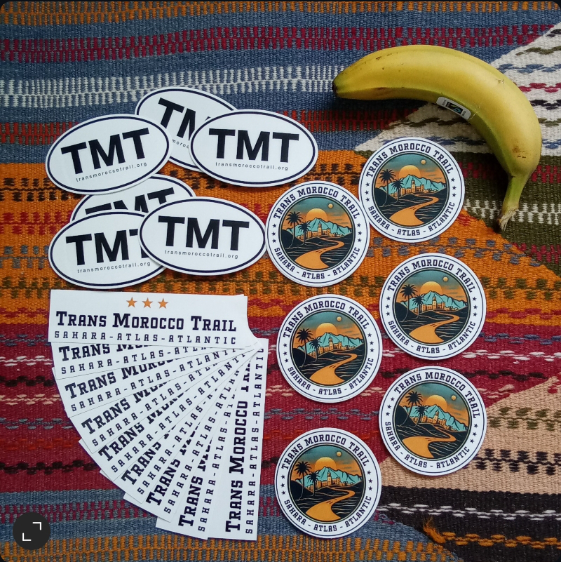
how do I get some TMT stickers?
Our 3-sticker TMT pack (below) is available here.
How can I support the TMT & H.A.T ?
Plan the Trails, do the Trails, enjoy the Trails, then spread the word by all the usual means. We’ve specifically designed this portal to be low maintenance, but respond to queries and update the maps, as needed. TMT Stickers and M4 book sales barely cover their own costs, let alone the time we’ve taken on all this, but that’s fine with us.
Better still, don’t support us, support Morocco’s rural economy. In particular, use family run-shops and stay in family-run auberges (lodges), not flashy, blinged-out kasbah palaces. The former can be basic, but your money is hopefully going straight into locals’ pockets, not some distant entrepreneur in Casablanca whose bought up a spread of places.
How do I suggest alternative routes for TMT or H.A.T ?
Unlike the TET and maybe the TAT, but like a BDR, the TMT and H.A.T follow a single uncomplicated line. And unlike the TET, there are no Linesmen regularly checking the two Trails. There’s only us and you. Our routes may get refined, but not by much. Adding options to the Trails gets too complicated.
However, we don’t expect you to follow the TMT or H.A.T religiously from end to end, because it was exploration which inspired us to create the Trails in the first place, not following other people’s tracklogs.
Enjoy your adventure along the Trans Morocco Trail and High Atlas Traverse and let us know all about it on the FB page.